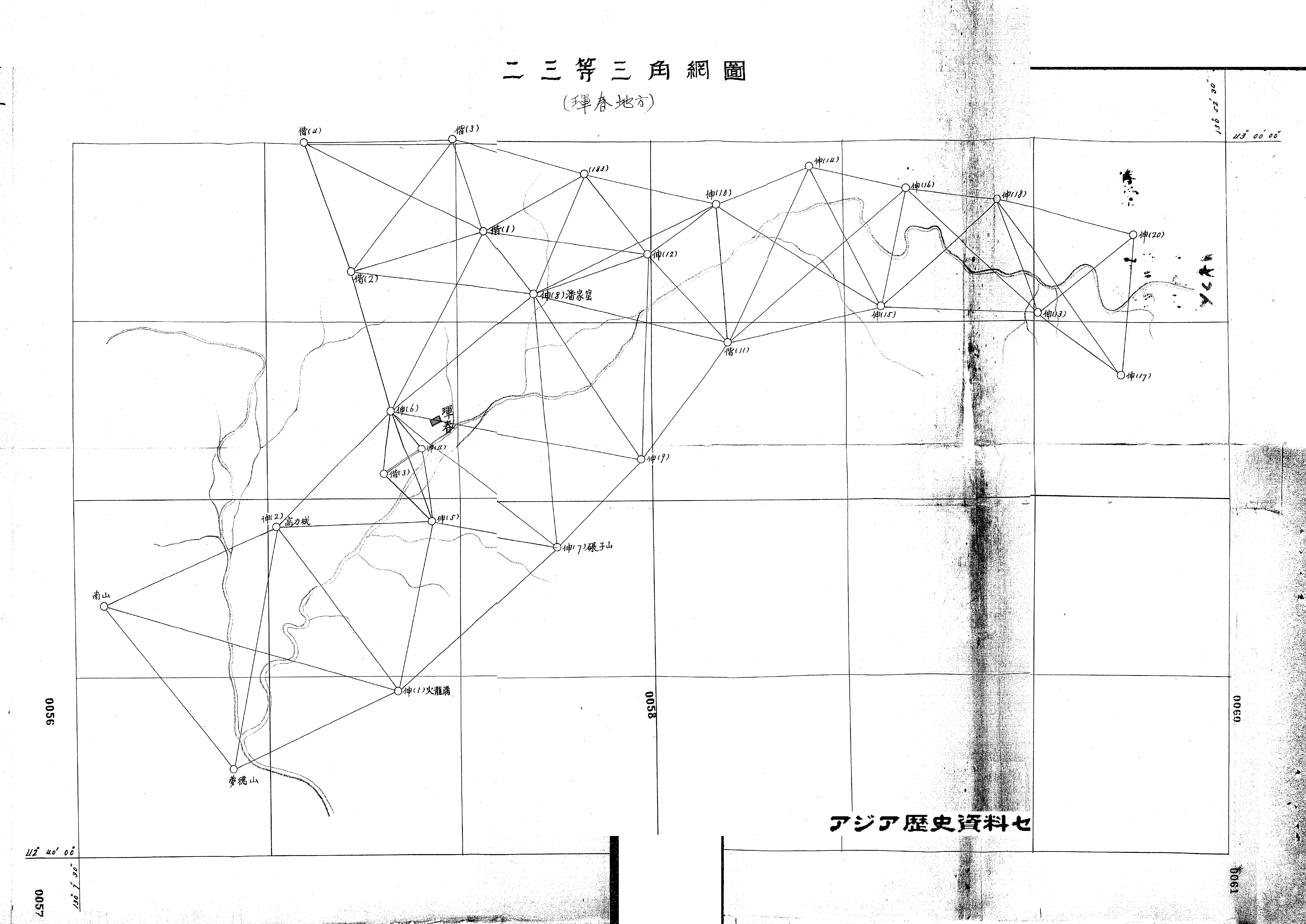
Despite the appearance of technological superiority compared to ground triangulation, a different set of problems ran rife in the process of taking aerial photographs and converting them into cartographic data. Aerial photographs in fact required new skills in “reading” images for cartographic information. Whereas aerial photographs flawlessly capture objects directly under the focal point of the camera, they grow increasingly oblique toward their peripheries: raised elements bend outward from the center, whereas sunken features warp inward. In short, the mathematical properties of projection between aerial photographs and coordinate systems differed significantly, calling for a highly technical vigilance in turning images into maps.
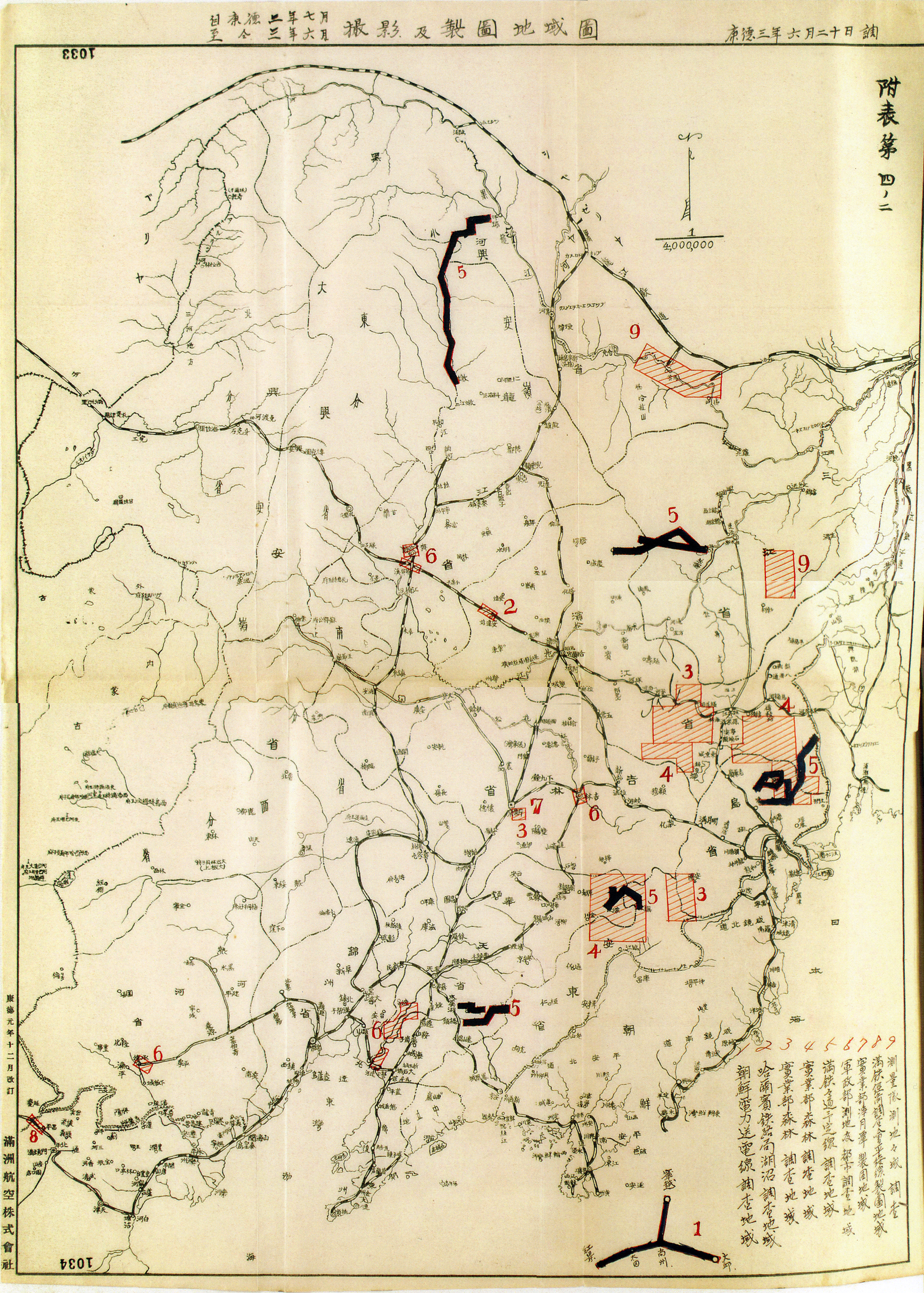
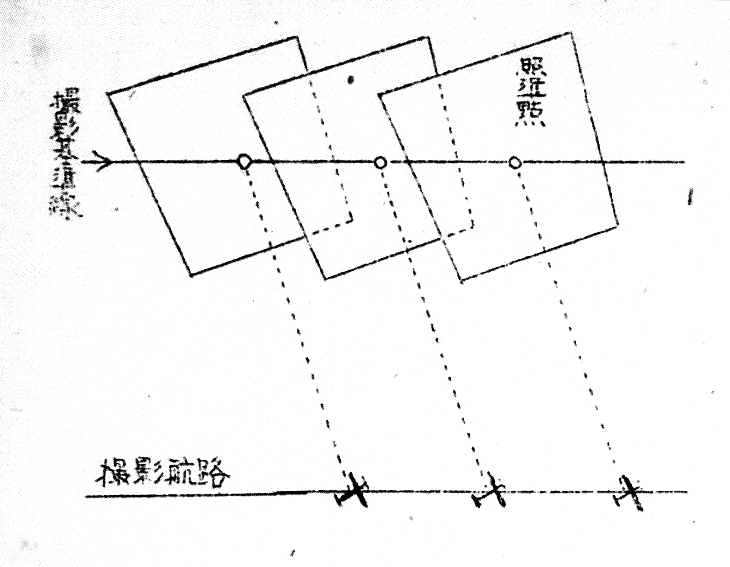
To keep this radial distortion in check, the photography bureau first took hundreds of overlapping images. Manchuria Aviation Company teams flew their planes in a straight line, winding back and forth, north to south, covering about 700 square kilometers per day.
While the pilot steered, the technician took photographs with a camera mounted downwards at meticulously timed intervals, perhaps every twenty seconds. The technician recorded the speed, altitude, and bearing of the plane at the click of the shutter. The pilot might have struggled to keep the aircraft on a stable course, or misread data on faulty altimeters, though experts could later enlarge or reduce the resulting photographs to a common scale. Once the two had completed this phase, they might have cross-checked their photographs by traversing the area again, this time from east to west.
Sometimes, however, the land itself seemed to resist Japanese efforts to document it. For example, the Sili-yin ġool desert in Inner Mongolia held a disorienting sameness from the sky. Two pilots there on assignment in 1937 reported that frequently they could not figure out where they had left off the day before because the dunes had shifted overnight, rendering the landscape unrecognizable.
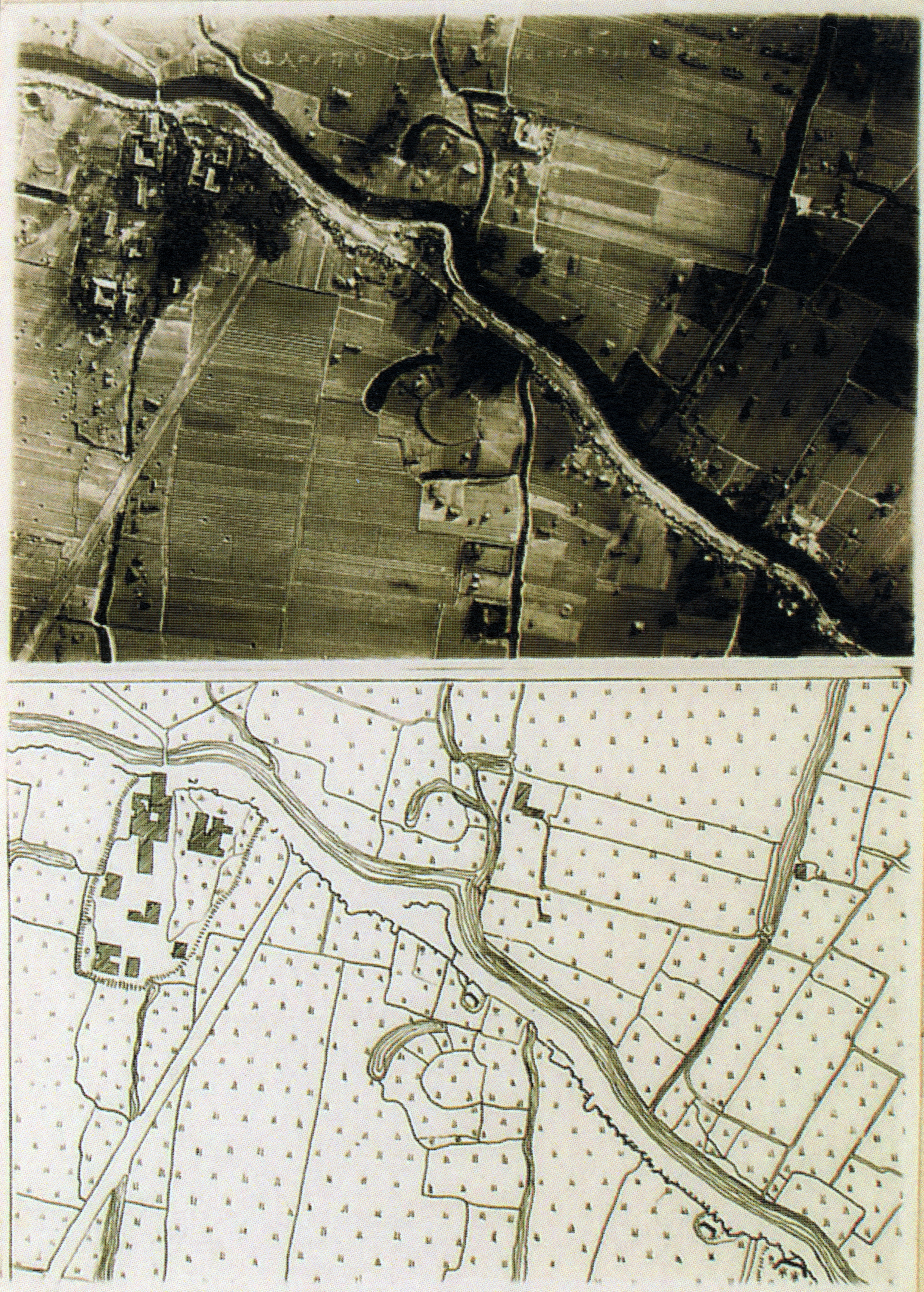
After developing the film, technicians arranged hundreds of diachronic pictures into an overlapping pattern known as an aerial mosaic, then reduced and traced the composite, as if to present a synchronic surface of the earth. As the image above from a Japanese aerial photography manual shows, these unwieldy assemblages consisted of many individual stills, each rectified and harmonized with its neighbors. Typically, photographs overlapped about 60 percent along the long axis of the flight lines, and 30 percent along the sides. Cartographers then derived elevation figures from mosaics using three-dimensional trigonometry. Mosaics were not so much taken as produced by technicians who edited images for tilt, blur, vibration, and scale. The final version gave the illusion of totality and precision, especially compared to maps drawn freehand from experience and memory, such as those featured in the module by David Ambaras.
Yet, as Paul Saint-Amour argues, the aerial mosaic “was anything but free from human error. It was, rather, a delicate pas de deux of error and counter-error.” To note this process does not mean to dismiss the accuracy of the photographs entirely; instead, writes Saint-Amour, these imbrications suggest a contingent, almost deceptive accuracy that lead viewers to believe in an integrated, synchronic reality rather than a diachronic series of pictures stitched together (Saint-Amour 2001). Maps derived from aerial photographs thus created a timeless representation emptied of life forms.