Infrastructural Planning
Aerial photography also held a revelatory power for its proponents. Manchuria Aviation Company pilots complained that they often discovered towns farther inland that had the wrong coordinates, or that did not even exist on triangulated maps. As touted in one of their handbooks, aerial photography made “the condition and quality of the land instantaneously obvious” (Manshū kōkū 1936).
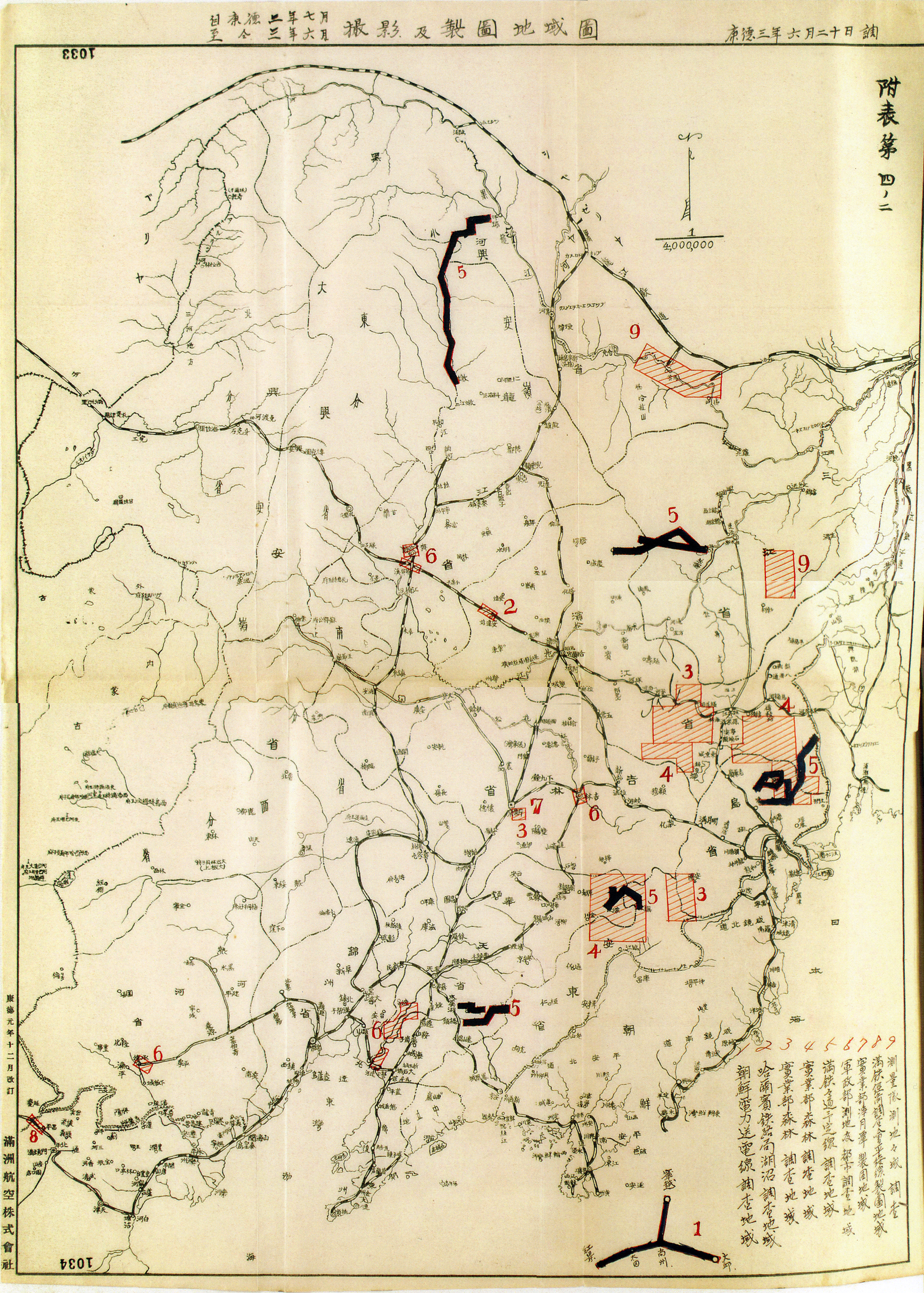
This revelatory power of the aerial photograph enabled the Japanese imperial apparatus to stage environmental interventions on a mass scale, throughout Manchukuo: agricultural schemes, deforestation, railroad building, dam construction, flood control. This scale far exceeded the geological extraction visualized by Chinese surveyors on foot in the Xing'an Tunken Project, as Shellen Wu shows in her module. Here, the bureau emphasized the crucial role of aerial photography as the “basis of research on Manchukuo’s resources…and development.” The maps below show the areas in Manchukuo surveyed by the photography bureau in 1936, 1938, and 1942, for infrastructural planning.
The prodigious photographic coverage by the Manchuria Aviation Company in the first three years of the bureau’s existence attests to this efficiency: 100,000 square kilometers of forests, 13,000 kilometers of railroads, 6600 square kilometers of salt fields, and 3400 square kilometers of urban areas. Furthermore, the photography bureau simplified and standardized an additional 500,000 square kilometers of property to maximize farm produce and state taxes. It distributed these images and maps to a variety of organizations, not only to the military, but also, as time went on, to the South Manchuria Railway Company, the Forestry and Industry Ministries, the Survey Corps, the Manchuria Colonization Company, the Manchuria Coal Mining Corporation, and more. The photography bureau, for example, drafted maps to help determine some of the largest hydroelectric projects in Manchukuo, the Su’pung and Fengman Dams.
Aerial photography allowed for Japanese planners to think spatially in restructuring the empire's economy. To this end, Prime Minister Konoe Fumimaro announced a national land planning program as part of his New Order Movement. Going beyond short-term five-year plans, the 1940 program endeavored to check the urban population, shift industrial zones, and protect rural areas.