This page was created by Michitake Aso. The last update was by Kate McDonald.
Northern Vietnam as Borderland
As the “cradle of Vietnamese civilization,” the Red River Delta has often been considered a heartland. Yet, the Red River Delta and its surrounding mid- and uplands have, like Xing An in Shellen Wu's module, often been cast as a contested borderland. Those invoking such a space imagined northern Vietnam in a regional geography that has referenced the immediately surrounding areas, including southern China. They also viewed northern Vietnam as part of larger commercialized and militarized spaces. Thus, northern Vietnam has been seen as either a core or a periphery, depending on the questions being asked and the interest of the viewer.
During the period of French colonization, Đại Nam was divided into Cochinchina, Annam, and Tonkin and formed part of French Indochina. The name Tonkin was mistakenly derived from an older name for Hanoi, Đông Kinh (東京) or eastern capital, and erroneously equated with the Vietnamese term Đàng Ngoài (the northern region of Vietnam). This newly created political unit was incorporated in a French imperial world. French commercial and imperial concerns continued to be interested in northern Vietnam's potential access to the markets of China. Here is a French map from 1894 showing Indochina's waterway connections to southern China.
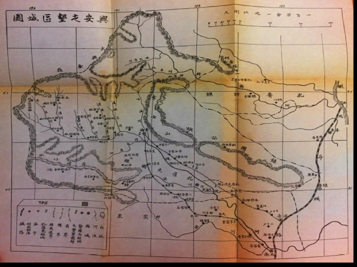
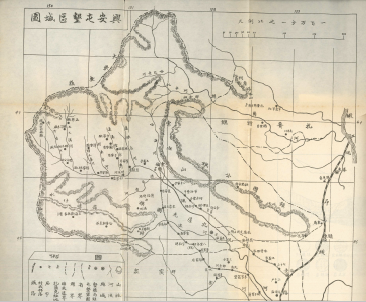
The following map shows the work of the commission sent by the French to delimit the border between China and “Annam.” Although this map does not give information about the people living in this borderland, by the early twentieth century, other French maps were filled with ethnographic knowledge. A 1905 map of the military territories that ringed the delta showed the presence of non-Việt ethnicities such as the Hmong and Tai and implied that they could be used to control both the border and the delta.
The following 1931 map shows some of the battles of the Sino-French war of 1884 and 1885. This map is included at the end of an essay on painting created after this war by Chinese artists and presented to the Qing Emperor. Note how this map only shows northern Vietnam, symbolically severing it from the Chinese context of the war.
Another depiction of northern Vietnam's military and commercial connection with southern China comes from the Asia Pacific War. When French Indochina was incorporated into maps of the Japanese empire. The following map comes from a 1940s Japanese publication aimed at school children showing French Indochina and China. This map emphasizes the waterways and railroad connections linking China to Hanoi and to points further south.
Finally, ethnic groups living in the uplands surrounding the Red River Delta had their own, non-cartographic, ways of mapping the highlands between Southeast Asia and China. The following map is from the perspective of someone from the Hmong ethnic group. It names “Mien” (Myanmar), Laos, and the Hmong territory of the uplands, presumably including northern Vietnam.
And finally consider a Google map perspective of someone looking east from the uplands towards the Tonkin Gulf.
This page has paths:
This page has tags:
This page is referenced by:
This page references:
- Xing An: A Contested Borderland
- Cai Peihuo's Inner Territory
- General Map of Operations During Sino-French War
- Hmong hand-stitched story cloth map of mainland Southeast Asia
- Red River Delta Looking East
- "Complete Sketch of Indochina" (1894)
- Carte de la zône frontière sino-annamite
- War Toward the South