The View from Above
Fleeting as it were, the aerial route across Inner Asia inspired visions of the continent from above. Touted as precise, revelatory, and efficient, aerial photographs seemed to grasp the lay of the land in an unprecedented immediacy.
The prevalence of aerial photography in the early twentieth century marked one phase within a longer history of combat and cinema technologies becoming increasingly intertwined. In what Paul Virilio calls “a logistics of military perception,” this mode of vision in the twentieth century led to “a dematerialization of reality [in which] a supply of images would become equivalent of an ammunitions supply” (Virilio 1989).
In producing distance between the viewer and the viewed, aerial photography contrasted sharply with, say, the familial intimacy fostered in picture albums, as Emily Chapman shows in her module.
How did a photograph taken from an airplane differ from one taken on foot or by railroad? Snapped in the Gobi Desert, the images to the right, from the popular magazine Geography Education (J. Chisei kyōiku), reveal the differences in perspective between the terrestrial and the aerial.
In this first image, the photographer stood among the sand dunes near the Inner Mongolian city of Baotou in northern Ordos, by the Yellow River.
In the second image, the photographer flew over Baotou at six hundred meters above ground (top) and the upper reaches of the Yellow River at eight hundred meters above ground (bottom). He also captured “a lamasery that was not even recorded on a map” in the middle of the Ordos steppe (center).
What is missing in the aerial photograph is the horizon. If the view of the horizon from a train corresponds to the panorama, as Wolfgang Schivelbusch writes, then the view from an airplane, in eliminating that horizon, might correspond to the map (Schivelbusch 1977).
Certainly, when flying over Inner Mongolia, pilots often conflated the aerial and cartographic perspective. As one wrote in 1937, “a line drawn on the map represented the route, with some letters written to indicate [the presence of] villages.” Peering out of the cockpit, though, he noted “a cast sea of millet grain where people never entered into the field of vision. As one would expect, the Gobi Desert looked exactly like what I had learned from a map” (Kawaida 1937).
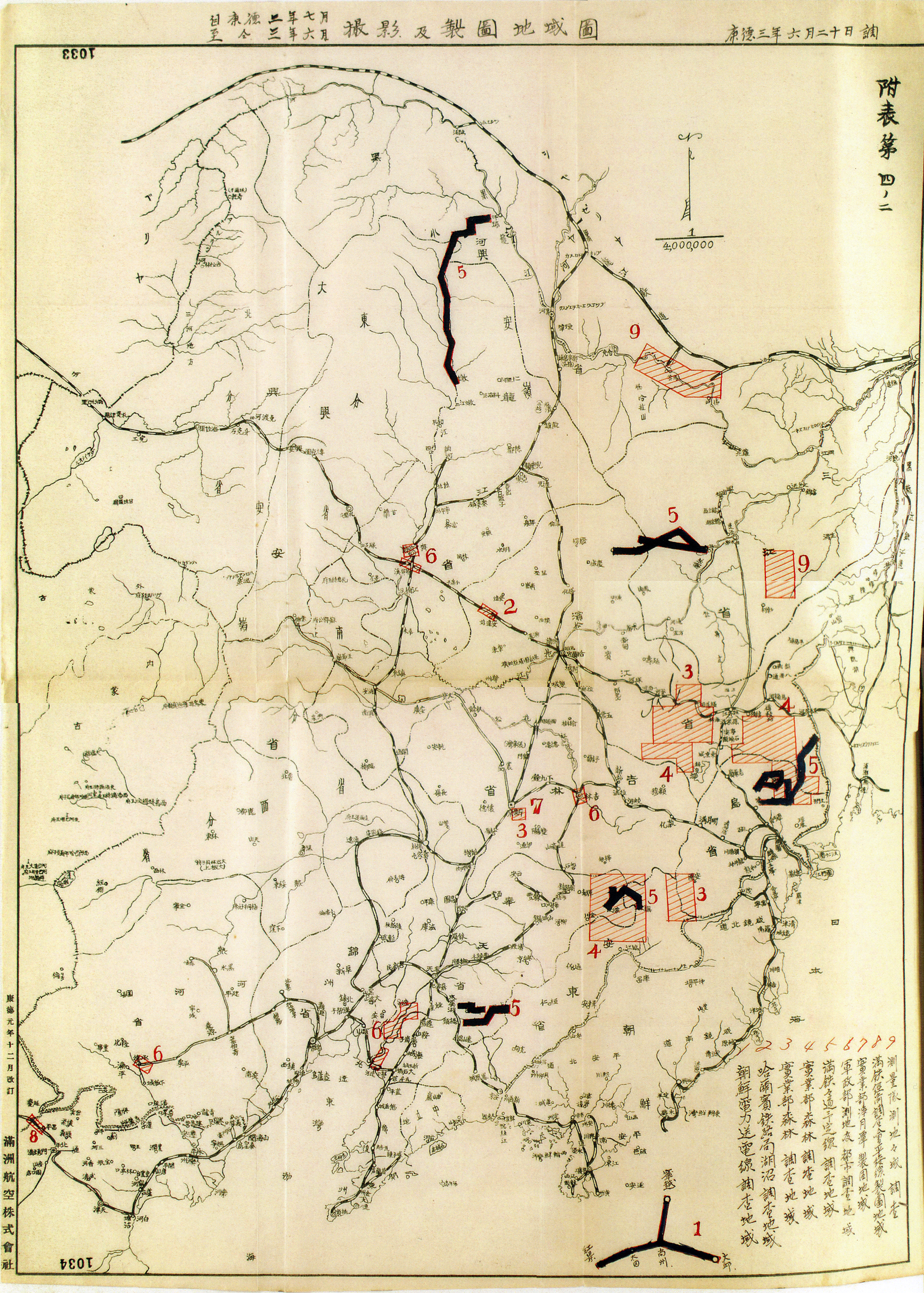
While Japanese pilots may have presumed that the aerial view equated the gridded map, to confuse these two perspectives, though, would prove costly, leading to “outrageous mistakes,” in the words of a technician at the Manchuria Aviation Company (Kataoka 1944). It would take a more intensive process to transform the former into the latter.
.jpg)
.jpg)
 low res_thumb.jpg)
 low res.jpg)
 low res_thumb.jpg)
 low res.jpg)