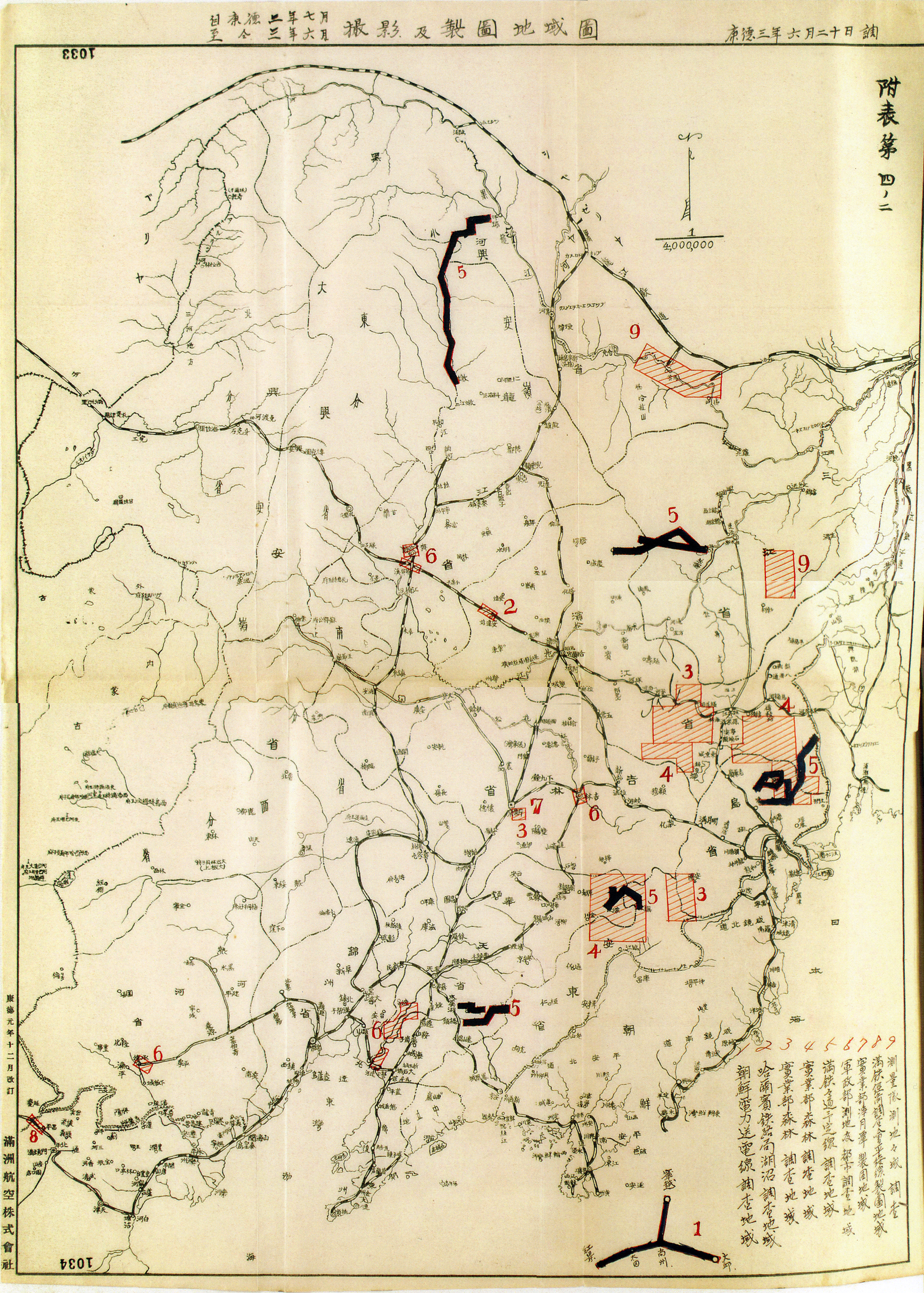
The Photography Bureau
The photography bureau of the Manchuria Aviation Company was responsible for capturing most of Northeast Asia on film and transforming images into maps. For Japan, deriving cartographic information from aerial photographs first came about on the continent through military interventions.
In 1928, the imperial army briefly occupied parts of Shandong and, under the command of Kimoto Ujifusa, photographed the Jiaoji Railway from the air. Kimoto authored many of the first manuals on aerial imaging in Japanese, and became director of the Manchuria Aviation Company photography bureau.
When organized in 1933, this photography bureau numbered two dozen or so technicians, two cameras, and two airplanes based in Fengtian. Kimoto himself visited the Zeiss factory in Germany to purchase and transport the hefty and expensive equipment to draw topographic maps from aerial images.