This page was created by Peter Thilly. The last update was by Kate McDonald.
Environment and Physical Geography
Environment and physical geography played key roles in how actors sought to maximize their opium profits. Below I discuss one aspect of this history that appears within the sources, and gesture towards another that is relevant to this story but not included in this module. Visitors to the module are encouraged to find additional ways that environment and physical geography might have affected the history of the opium trade, and to use this concept to link this module to the others.
Where mountains meet the sea
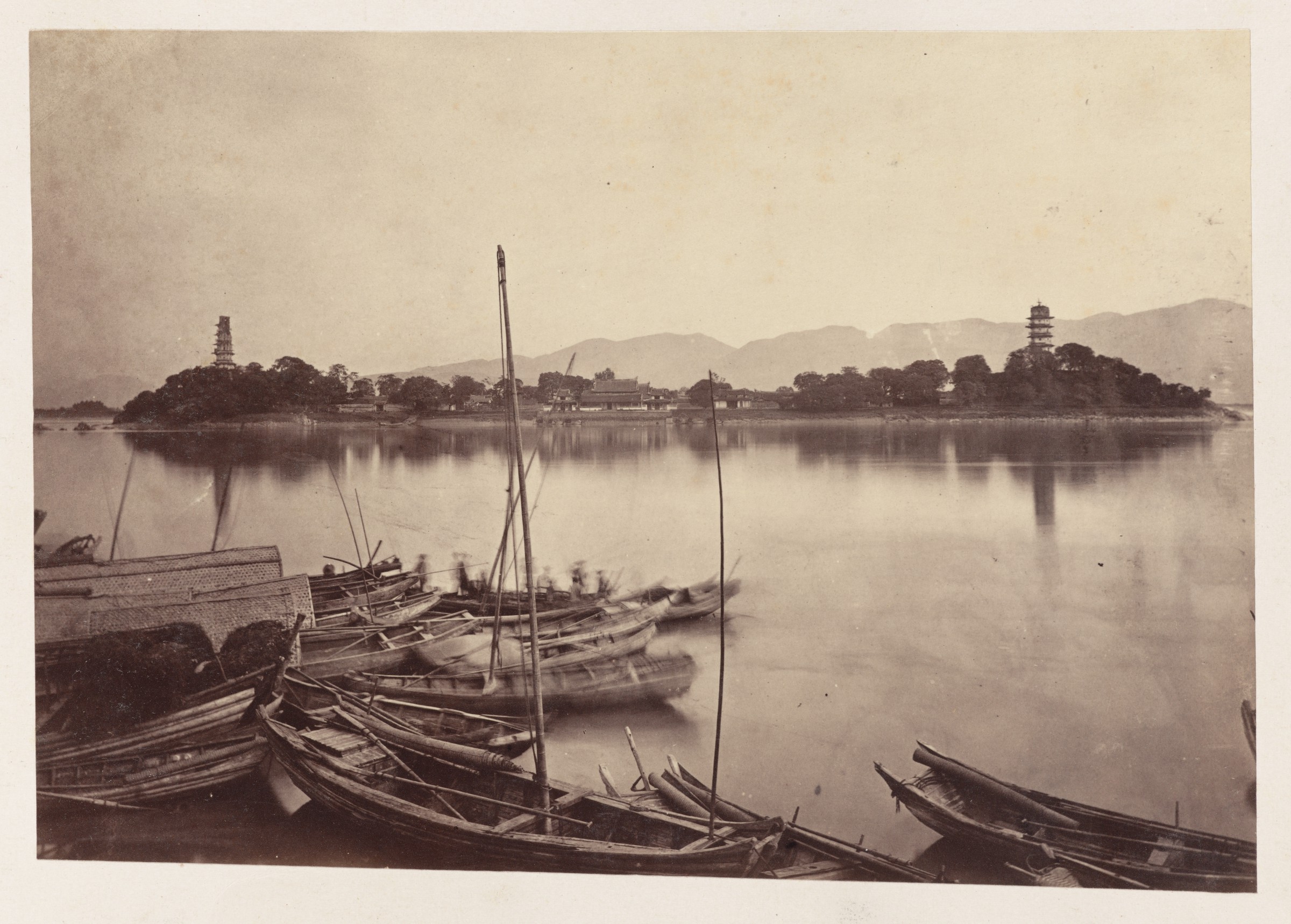
The Fujian littoral is a place of jagged coastline, small bays, scatterings of islands, winding peninsulas, and steep mountains that ascend from the shoreline. In short, it was and remains an extremely difficult place for states to keep watch over. The region's first foreign Commissioner of Customs, F. Nevill May, wrote in 1865 that Fujian’s mountains and rivers present “so many obstacles to the construction of canals and railways that they will probably never be introduced into this part of China.”* Fuzhou and Wenzhou—a large city in coastal Zhejiang only 207 miles north of Fuzhou—were only recently connected by rail, in 2003. The construction necessitated the excavation of no fewer than 53 tunnels.
The map below is geotagged to Xiamen, Shenhu Bay, Quanzhou, and Fuzhou in order to enable users to view the entirety of the Fujian coast from above (much like how the Japanese state sought to use airplanes to achieve a new view of Inner Asia). Zoom in and consider for yourself how difficult it must have been for the Qing state to try and keep powerful lineages like the Yakou Shi from breaking maritime laws.
The jagged and winding nature of the Fujian littoral was clearly an important part of the success of the Chinese and foreign network of opium traders discussed in this module. Because the opium trade was nominally illegal, the ideal scenario for people like Shi Hou and John Rees was to keep their dealings entirely invisible from the state. Arranging clandestine meetups offshore was clearly the way to go.
As the years went on, it became impossible for a trade of this volume to go on without any government awareness. Recall the video of Shenhu Bay: any person in any of the villages that overlook the bay and any person that travelled to the bay would have been able to see the British opium ships and the boats of their Chinese opium customers. It simply isn't that big of a place. Thus, as discussed more extensively elsewhere in this module, the opium smugglers of Yakou village and their British partners offshore arranged for systematic bribery of local officials to keep the trade going. At that point, the utility of a geographic location like Shenhu Bay was that it was not visible from other, more well-garrisoned parts of the coast. Officials who took bribes, it should be remembered, also needed to keep their secrets.
Environment, topography, and opium cultivation
The cultivation of opium poppies and production of opium is another side of the history of opium profits, which for the most part is not touched on within the sources included in this module. Historian Rolf Bauer's new book The Peasant Production of Opium in Nineteenth-Century India (Brill, 2019) is a fantastic place to start for anyone interested in this side of the story. Bauer's research into the production of Patna opium in India is exhaustive and wide-ranging, including detailed analyses of social formations, labor practices, and the changing interactions between peasant cultivators and the physical landscape over a century of opium production. Consider the following passage on irrigation in two environmentally very similar parts of India: Gaya, an opium producing region just south of the city of Patna, and Saran, just to the north of Patna. As Bauer shows us, there are rich possibilities for a spatial history of opium production, tracing out the interactions between human actors and the physical environment in the pursuit of opium profits:
Gaya's agriculturalists constructed irrigation facilities because the natural conditions basically forced them to. Saran's agriculturalists were less pressed to do so because the district's soil easily retained moisture… How can we explain this difference despite the similar conditions? Saran's relative progress was ascribed to the ambition of the local sub-deputy opium agent, then a Mr. Tytler, who was known for encouraging the construction of wells. On the one hand, this must be seen as a positive investment in Saran's infrastructure. On the other hand, the contracts for the construction of wells were a powerful tool to further press the cultivators.**
*Chinese Maritime Customs Microfilm, Reel 4, “Return on Trade at the Port of Foochow for the Year 1865.”
**Rolf Bauer, The Peasant Production of Opium in Nineteenth-Century India (Brill, 2019), p. 107.
This page has paths:
This page has tags:
This page is referenced by:
This page references:
- The View from Above
- Constructing a Water Town: The River, the Sea, and the Communities in Wenzhou
- Main Menu
- Chimmo (Shenhu) Bay
- The Case Against Shi Hou: A Qing Document
- Quanzhou
- The Rees Brothers: Big and Little Li
- Corruption and Bribery
- Fuzhou
- Patna
- Xiamen (Amoy)
- Video of Shenhu Bay, from Yakou Village