A Rain of Ruin
These plans came to fruition on March 9, 1945, when 334 B-29s Superfortresses, each loaded with roughly 5.5 tons of M-69 jellied gasoline cluster bombs, took off from their base in the Marianas headed for Tokyo. Once over the capital, wave after wave of B-29s emptied their incendiary payloads into “Target Zone 1”—an area that corresponds almost perfectly to the flammable, built up regions highlighted in previous planning documents.
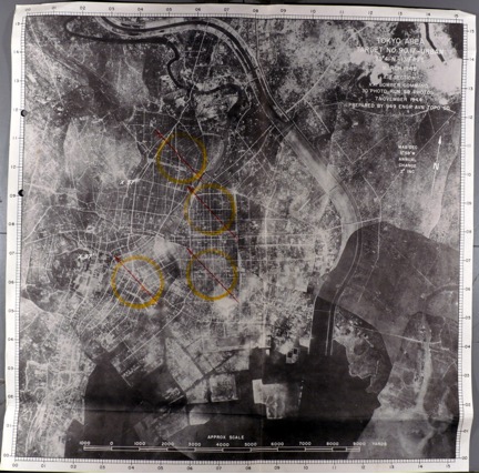
The effects were devastating. As planners had hoped and USAAF meteorologists predicted, fires stoked in the initial target zone were swiftly stoked into a great conflagration that enveloped most of Eastern Tokyo. Overnight, much of the low-city was carbonized. Although estimates on the casualties exacted by this raid remain disputed, it can safely be said that 100,000 civilians perished in the flames, while over one million more were left homeless (Selden 2007). Yet what most captivated American eyes was the birds-eye-view of destruction. The toll of this raid and the many to follow in its wake was to be measured in square miles not human lives. It was to be documented, if not celebrated, through aerial photographs that capture the staggering scope of burned out urban fabric (Fedman and Karacas, 2014).