Problems with Triangulation
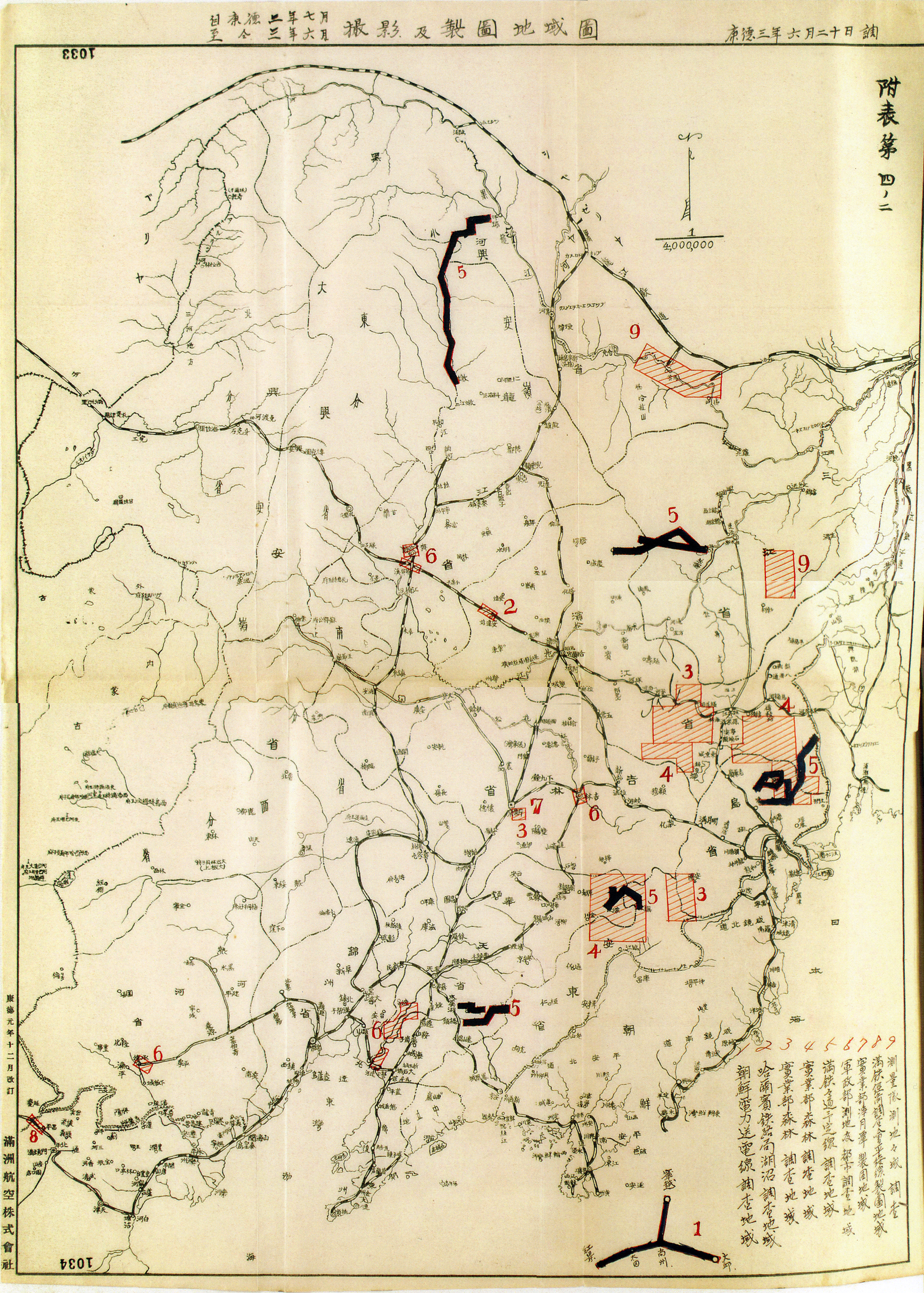
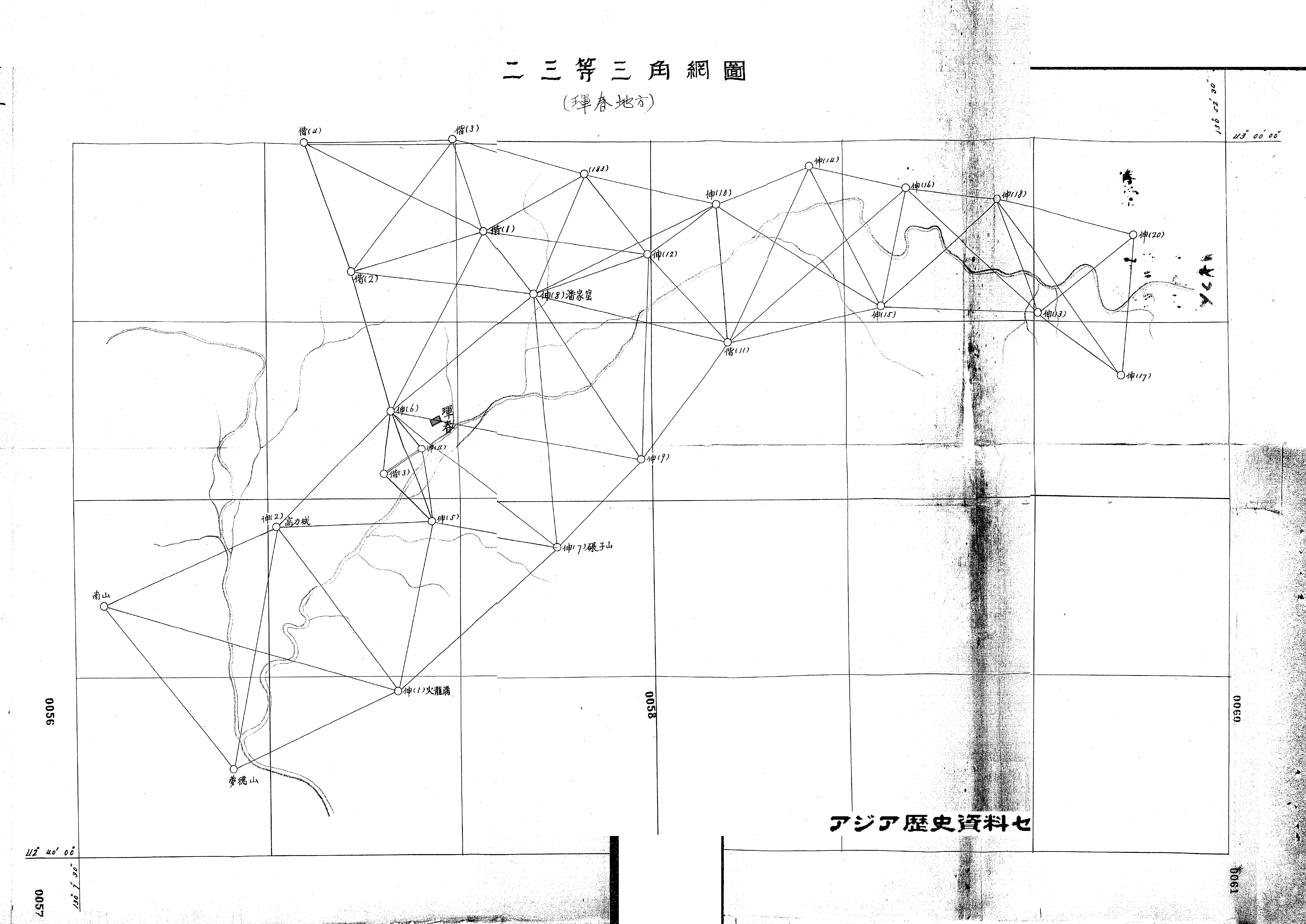
The Japanese imperial land survey department had begun mapping out northeast China from the early 1900s, and inaugurated the official triangulation survey of Manchukuo in 1933. Teams of eight, ten, sometimes more, would spend several days in the countryside determining points, angles, distances, and elevations to draft iterative ‘chains’ of triangles for trigonometric calculation, like the one above of the Hunchun area near the Korean border. There, they encountered bandits who occasionally robbed, even killed, workers. The mapping chains overlapped entirely with Manchukuo’s railroad network, not only for security reasons but also for the simple fact that the rail passed through most of the country’s denser communities. Despite its pretenses of approaching “the cartographic ideal,” by the advent of the airplane, trigonometric rhetoric could no longer ignore the shortcomings of triangulation: the imprecision, the illegibility, and the inefficiency of it all.